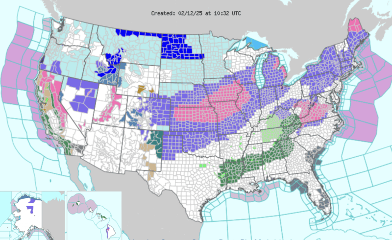
Winter Storm Warnings in place for 14 U.S. states
A period of active weather is taking over much of the United States, with heavy snow, rain and ice expected from the Central Plains, the Midwest, the Great Lakes and out toward the Mid-Atlantic. As of Tuesday afternoon (February 11, 2025), Winter Storm Warnings were issued for at least 14 states. The criteria for Winter Storm Warnings vary from region to region. Here’s the National Weather Service definition:
A Winter Storm Warning indicates that heavy snow of at least 6 inches [15cm] in 12 hours, or at least 8 inches [20 cm] in 24 hours, is expected. It can also be issued if sleet accumulation will be at least half an inch [1 cm].
The main thing to remember is this: if a Winter Storm Warning is issued in your area, there’s a chance for snow and/or ice accumulations expected to be significant enough to cause impacts and disruptions. The National Weather Service said this morning:
A winter storm will continue to impact the Mid-Atlantic through tonight with areas of heavy snow, sleet and freezing rain. A winter storm will begin to impact the Central Plains Wednesday, bringing heavy snow from central Kansas through much of Lower Michigan. This system will also produce a wintry mix of sleet and freezing rain from central Oklahoma through Missouri and into Ohio.
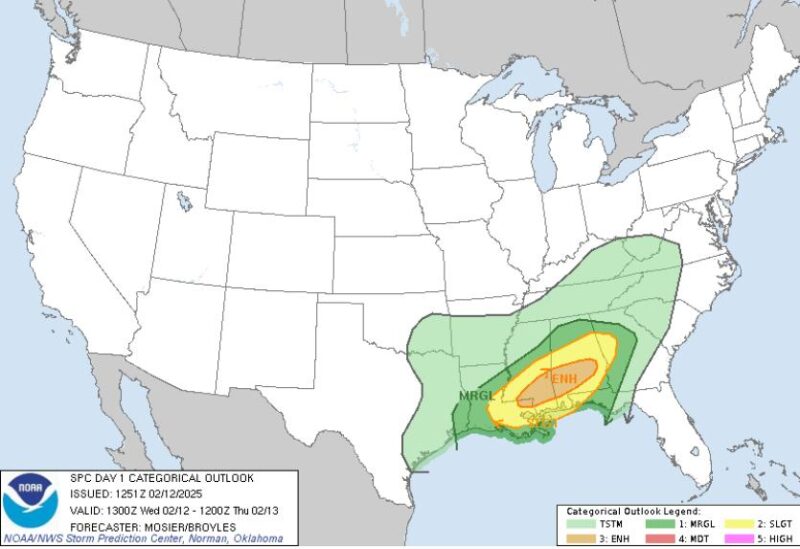
And that’s not all. There’s also a risk for heavy rain, thunderstorms and possibly tornadoes for some. The forecast for severe weather was upgraded Wednesday morning (February 12) to a 10% chance in the forecast area. Previously it was a slight risk, which is roughly 2-5%.
What’s causing this winter storm?
Arctic high pressure moved south Tuesday, bringing cold weather across the central United States as moisture was moving north from the Gulf. As these two air masses met around an area of low pressure, it set the stage for the winter storm. On the northern side of the low pressure, where temperatures are coldest, is where the snow will fall. As the low pressure moves northeast, it takes the risk for snow across the country on its path. Closer to the low pressure where temperatures are still cold (but not as cold as north of the low), a mix of rain, snow and sleet is possible, and also freezing rain.
For some, risk of heavy rain and thunderstorms
South of the low pressure is the warmer side. And on the southern side of this winter storm comes the risk of severe weather Wednesday for Louisiana, Mississippi and Alabama.
As the low pressure treks northeast across the United States toward the Great Lakes, it should get stronger. In addition to the low pressure becoming strong, a cold front will develop. This will divide the cold, Arctic air that had settled into the Plains and the warmer, more moist air coming up from the Gulf.
As the cold front moves across Louisiana, Mississippi and Alabama, rain and storms will develop along the boundary, creating a risk for heavy rain and severe thunderstorms.
The Storm Prediction Center (SPC), based out of Norman, Oklahoma, has placed this region at a Level 3 on a 5-scale system, as of Wednesday morning.
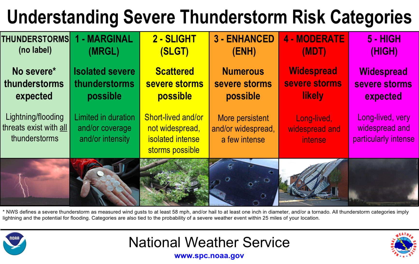
Severe storms
Severe storms are possible in the outlined forecast area from Wednesday afternoon through early Thursday morning. The main threats from these severe storms will be damaging wind gusts of 58 miles per hour (93 kph) or higher and isolated tornadoes.
While severe weather can happen at any time of year if conditions are right, it’s not that common in February. According to data from the SPC, any severe risk for February 12th is approximately 1% (the data window is from 1982 to 2011). It is important to note that where this 1% severe weather probability risk is outlined is where severe weather is possible Wednesday. This correlates with the warm, moist air coming in from the Gulf that interacts with cold air in the central U.S. in late winter.
Dangerous travel conditions across Plains
Snow started falling late Tuesday night across Kansas. The system will move northeast across the Plains into the Great Lakes through the day Wednesday and into Thursday. As it does, it should drop heavy snow, creating dangerous travel conditions for major interstates in the middle part of the U.S.
From northern Kansas, southeast Nebraska, northern Missouri, central Iowa, northern Illinois and southern Wisconsin, a swath of heavy snow is expected to total 6-8 inches (15-20 cm) through Thursday afternoon, with snowfall rates of up to 1 inches (2.5 cm) per hour according to the National Weather Service.
The storm will continue to strengthen as it moves northeast through the Great Lakes, dropping 5-8 inches (12-20 cm) of snow across the lower peninsula of Michigan. In addition to the heavy snow, there’s the possibility of a thin area of freezing rain, creating accumulating ice of up to 0.1 inch (0.2 cm) from southern Missouri through central Illinois. A few locations, especially south of St. Louis, could receive nearly 0.2 inch (0.5 cm) of ice. Anything above 0.2 inch of ice can create enough weight on tree limbs and power lines to cause damage and possible power outages.
Bottom Line: A strong winter storm is moving across the U.S. on Wednesday, February 12. It is expected to drop heavy snow and ice, and to create severe weather in the form of damaging wind gusts and isolated tornadoes.
Sources: National Weather Service
National Oceanic and Atmospheric Administration
Read more: Freezing rain: The beauty and the danger
Source link
Read More
Visit Our Site
Read our previous article: Gravitational waves could turn colliding neutron stars into ‘cosmic tuning forks’