The Invisible Forces Behind Strong Winds
To understand strong winds, you first need to know this: wind is moving air caused by pressure differences in the atmosphere. The sun heats the Earth unevenly. Areas near the equator get more warmth than the poles. This causes hot air to rise and cold air to sink, creating air pressure systems. Air always wants to move from high pressure to low pressure. This movement is what we feel as wind. The greater the pressure difference, the faster the wind moves. Weather scientists call this a pressure gradient.
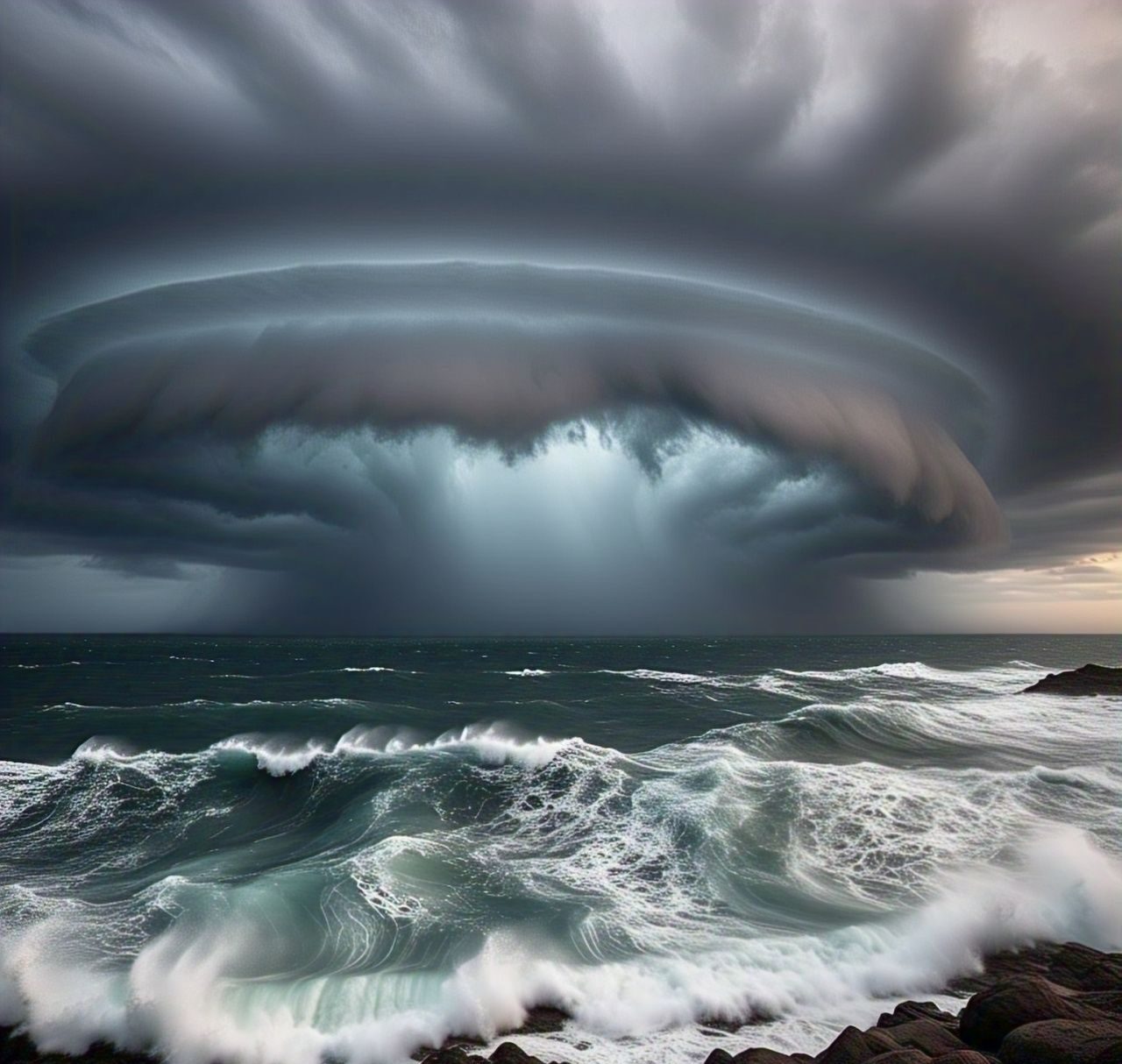
Another invisible force is the Coriolis effect, which bends wind due to the Earth’s rotation. It doesn’t push wind but redirects it. Combined with solar heating, this effect creates large swirling air patterns known as jet streams. These high-altitude rivers of wind can travel over 200 mph and influence weather across continents. When they shift, storms can build up quickly, leading to extreme wind events.
How Earth’s Features Shape Wind Patterns
The shape of the land matters a lot. Mountains, valleys, lakes, and plains all affect how wind flows. When wind hits a mountain, it’s forced to rise. This can create powerful downward gusts on the other side, called mountain waves. In places like the Rockies, these can blow over trucks and planes. In valleys, wind is funneled and can gain speed, creating sudden blasts known as katabatic winds. Coastal areas also feel strong winds due to the temperature contrast between land and sea.
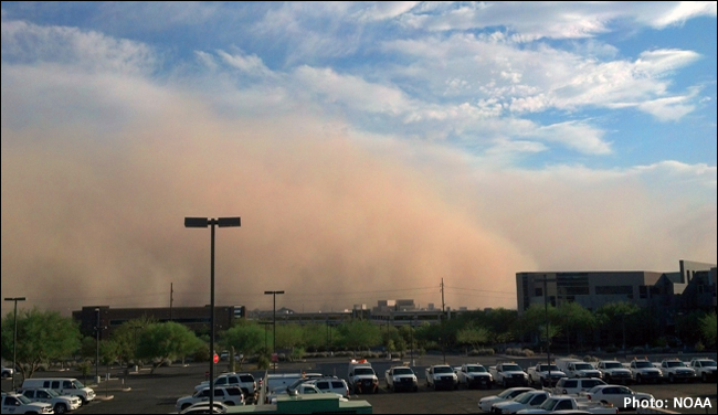
Urban areas can change wind patterns too. Tall buildings create narrow paths, turning streets into wind tunnels. Forests slow wind down, while deserts can let it move fast and far. One well-known example is the Santa Ana winds in Southern California. These hot, dry winds move from inland deserts to the coast and often bring wildfires. Scientists track them using local sensors and satellites to help warn communities.
Tools and Techniques Weather Scientists Use
Weather scientists, also called meteorologists, use many tools to measure and predict wind. Anemometers are devices that spin in the wind to show speed. Wind vanes point in the direction the wind is blowing. Weather balloons go high into the sky and collect data on temperature, pressure, and humidity. These tools help create a full picture of the atmosphere.
Today’s forecasts depend heavily on computer models. These models take real-time data from satellites and ground sensors and use math to predict how air will move. They can show where a windstorm might hit, how fast it may blow, and what areas are at risk. Doppler radar, often used in storm tracking, can even show wind moving inside a thunderstorm. New tools like AI forecasting are helping scientists get even better at predicting wind events days in advance.
What Fuels Powerful Winds in the USA?
In the United States, different areas have different wind patterns due to climate and terrain. The Great Plains, from Texas to the Dakotas, often see strong straight-line winds called derechos. These happen during thunderstorms when cool air from the storm dives down and pushes air out in all directions. This can flatten trees and damage buildings. In the Southeast, especially Florida and the Gulf Coast, hurricanes bring deadly wind speeds, fueled by warm ocean waters and spinning storm systems.
Arctic cold fronts that sweep down from Canada in winter can meet warm, moist air from the Gulf. When these air masses clash, they often spark powerful windstorms and tornadoes. In summer, the West faces dry downslopes that raise wildfire risks. Each region of the U.S. has its own type of wind danger, and all are studied closely by meteorologists to improve forecasting and safety.

When Wind Turns Dangerous: Real Events Explained
Some wind events make history. In August 2020, a derecho storm ripped across Iowa, with winds topping 140 mph. Millions of trees were destroyed, and damage reached over $11 billion. What caused it? A long line of thunderstorms, fueled by heat and high moisture, released violent wind bursts that acted like a hurricane over land. In 2005, Hurricane Katrina hit New Orleans with winds of 125 mph. Warm Gulf waters, low-pressure systems, and jet stream shifts all helped fuel its strength.
Tornadoes are also driven by sharp contrasts in air temperature and wind direction. These spinning columns of air form quickly and can be devastating. After each major event, scientists study satellite images, ground damage, and radar data to understand what fueled the winds. These studies help build better warning systems and improve building codes to reduce future damage.
Surprising Wind Facts You Didn’t Know
Winds can do more than just move leaves. They shape sand dunes, carve rock formations, and even transport seeds and insects across continents. Here are some surprising facts about wind:
| Wind Fact | Detail |
|---|---|
| Fastest wind ever recorded | 253 mph during Cyclone Olivia in 1996 (Australia) |
| Wind can carry | Dust, pollen, bacteria, and even small insects over oceans |
| Windiest U.S. city | Dodge City, Kansas (average wind speed of 13.9 mph) |
| Wind energy use | Powers over 10% of electricity in some U.S. states |
| Strongest U.S. gust | 231 mph at Mount Washington, New Hampshire in 1934 |
What We’re Still Learning About Wind
The question “what fuels powerful winds? Answers from a weather scientist” leads us to many layers of knowledge—sunlight, air pressure, terrain, and temperature changes all play a part. As technology improves, weather scientists uncover more about wind’s behavior and how it interacts with the environment.
Yet, there’s still more to learn. Wind patterns are shifting due to climate change, and new types of storms may form in the future. Keeping up with trusted sources like NOAA and the National Weather Service helps you stay informed. If you’ve ever been caught in a windstorm, you know how powerful air can be. What’s the windiest moment you’ve ever faced? Share your story in the comments.
FAQs
What causes sudden wind gusts in calm weather?
Sudden gusts can come from uneven heating on the ground, nearby storms, or passing cold fronts that shift air quickly.
Are high winds always connected to storms?
No, winds can occur on clear days too. Strong pressure differences without rain or clouds can create very windy conditions.
How do weather scientists measure wind accurately?
They use tools like anemometers and Doppler radar, along with satellite data and balloon readings, to track wind speed and direction.
Can wind speeds change rapidly in the same location?
Yes, depending on terrain, temperature shifts, or approaching systems, wind can increase or drop within minutes.
Is climate change making winds stronger?
Some studies suggest that warmer oceans and shifting jet streams could lead to more frequent and intense wind events.
Read our previous article: Spring Triangle in the east at night, heralding the season